But with all due respect, I don't think that's the right question. It's really not even a question: it's a statement that implies the university is not preserving land, and that the state is actually encouraging and financing green space acquisition in other communities in a meaningful way. Neither implication is accurate; according to the most recent data, the University owns 42,000+ acres all over the state, much of it used for forestry and agriculture. According to sources, UGA's land assets have been growing in recent years. And the state's support for greenspace acquisition is half-hearted, at best, especially in tough budget times (perhaps we can tackle that another day).
UGA's land holdings further its mission as a land grant institution; I think it is fair to say it has done its part to preserve land. UGA land holdings include extensive acreage in Oconee County, including new acreage for its national champion equestrian team and horticulture and crop experiment farms. It has significant holdings in Griffin, Tift County, Jackson County, Morgan county and elsewhere. However, the article's main thrust -- that there needs to be a conversation and plan for South Milledge, does resonate.
In part one of the Flagpole piece, the author takes a look at how other institutions manage their land uses. He even invokes my alma mater as an example of using (and marketing) its land resources differently than UGA. While I love Berry and its landholdings, and applaud the way it is (finally) using its land assets to better educate students, the author failed to mention a key point. Berry aggressively harvests timber from its 26,000 acres to generate revenue and allows extensive hunting on its campus under an agreement with DNR. I can't imagine hunting and logging going over well on UGA owned land in Athens-Clarke County.
One also has to wonder how much of this conversation has emerged because of the opposition of Athens FAQ to the location of NBAF along South Milledge. To me, it always seemed that opposition to the facility was driven as much by its potential location as it was by scientific reasons (although to be fair, FAQ did bring up plenty of those as well).
The South Milledge site was never the favored choice by UGA and others for NBAF -- they wanted a site adjacent to the Richard B. Russell center, where NBAF would be tucked away behind another large government building, hopefully out of sight and largely out of mind. But the controversy that emerged shows how emotional the community is about the pastoral acreage along South Milledge.
I understand why. For many in Watkinsville, south Oconee and parts of Clarke, this corridor offers a great transition from "Urban Athens" to the more pastoral Oconee County. For cyclists, it is the primary "escape route" from Athens to the rural roads of Oconee, Walton, and Morgan counties. It is a breath of fresh air at the end of a long day.
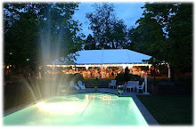
But is it realistic to expect this corridor to stay completely rural forever? Probably not. Already, "light recreational uses" have been added with new intramural and athletic fields, and more are planned (see
 picture). The agricultural operations that do exist out there can be relatively intense and I would imagine are not environmentally neutral. A sewage treatment plant along the corridor often adds its own special scent to the area on warm summer days.
In a conversation with Kevin Kirsche from the University Architect's office, he confirms that he is supportive of an inclusive planning effort for the corridor, which was not addressed in the University's 1998 master planning.
"In truth, I thought there were a lot of good points in [the Flagpole] articles," said Kirsche. He's right. There were.
A planning process that engages and educates the community is a positive and necessary step. However, as we learned on NBAF, it is likely that the loudest cries will come from those who want nothing to change.
Kirsche has obviously done some thinking in that regard. While he stresses that no large scale changes are planned in the immediate future for the corridor, he allows that over time, as the University grows, some change will occur.
"One thing we have discussed [at the University Architect's office] is that it is perhaps not realistic to think that as the University continues to grow over time that South Milledge will remain rural or agricultural. But we love the rural experience out there," said Kirsche. "We have talked about ways to maintain that character."
He went on, discussing the protection of view lines into natural areas, designating areas that should be preserved, analyzing "viewsheds", identifying nodes for development, and using linked landscape corridors. Heady stuff.
So, what does all this mean? In short, expect more discussion about the future of the corridor, especially in years ahead once UGA is further along with its ongoing efforts to densify and redevelop its core campus area, as outlined by the 1998 master plan.
Here's my idea. How about activating the rail line that links Whitehall Village with UGA and the multi-modal center as a double-tracked light rail system with a running and biking trail alongside?
This sort of usage might allow for small "village" type development to be built, or event better, the re-establishment of Whitehall Village (the old part, not the new subdivision) as a student and educational community. Whitehall Village includes the old mill homes and brick structures that sprang up around the old Factory on the banks of the Oconee River now known as the Whitehall Mill lofts; these homes and some older factories line Whitehall Road up and down the hill between the railroad tracks and Barnett Shoals Road. By using UGA's transit expertise and an old rail line, a car-free way for students to get to and from main campus would be created and an old town re-established.
Facilitating the redevelopment and preservation of Whitehall Mill Village as a cultural and historical -- but living -- resource for learning and student housing, all within the footprint of a historic community, would be an amazing service to the state and the community. And imagine if this village was linked to campus with light rail and a paved cycling and running trail that eventually continued to Watkinsville?
One other plus: the addition of a rail and transit corridor to the mix suddenly allows for this to happen without pressure to four-lane Milledge or Whitehall, which almost no one wants.
On-campus rail does not appear to be a new concept for UGA. In doing some research on an unrelated project, I found a web page with decades worth of
 campus planning maps. Interestingly, the one from 1967 (pictured) calls for a looping rail line running through campus in what is now the intramural fields and around North Campus and Sanford Stadium. According to Kirsche, this concept was designed in an effort to secure a federally funded monorail, which eventually went to West Virginia University.
While this sort of monorail is out of vogue today, the existing infrastructure is arguably better. The existing underutilized freight line runs within 1/4 mile of almost all campus assets. Even without Whitehall Village in play, one has to wonder if the community and UGA could partner to to put this rail line to work to remove cars and buses from our streets and offer a unique marketing and lifestyle option not found on many southern campuses, while preserving it as a cargo route for a few key customers.
As a final note, I would be in remiss if I didn't add that if South Milledge is going to be developed in any form or fashion, I think it is a positive that the University would be handling it. While one can disagree with the style and/or substance of what is built at UGA these days, no one can question the commitment to quality construction, aggressive and impactful landscaping, inclusion of green space, and thoughtful planning.
As someone who has lived in this area for the better part of 30 years, the gracious landscaping, additions of green spaces like the D.W. Brooks mall, and the re-greening of campus in the past 15 years is an impressive accomplishment, and continues a legacy of horticultural passion that helped initiate a campus arboretum years ago. According to Kirsche, 34 acres of greenspace have been added to UGA's main campus alone in the past 1o years. Those of us who remember Herty Field as a parking lot and the less than impressive entry corridors to campus from years past certainly appreciate the University's efforts to "green up" all parts of campus today.
Kirsche's final thought on South Milledge is this: "We would like to have a logical, well constructed plan for conservation of land as well as potential development in the future."
Agreed -- so what are your thoughts on the future of South Milledge? And Kudos to Flagpole for kicking off the conversation.


11 comments:
Well put.
My only genuine beef with NBAF was where they wanted to stick it. If they would have been able to plop it over by the EPA building that would have been OK with me.
I have no doubt that route will be developed one day. The "viewsheds" are an interesting consideration and much more preferable to fields of parking lots. I would love to see just a bit more of that land turned into recreational trails (...finding someway to link with the current IM fields, rail/trail etc would make a wonderful addition to the area imho...
If they use the viewshed idea, I hope they pencil in a few cows and sheep. That completes the picture (illusion) for me on my drives home....but if they put in a rail to trail, I might have an easier time biking in....)
I say if we want this corridor to retain is rural setting and two lane roads passing through it we should make no attempt to increase its attractiveness to others. A Whitehall Mill community connected to UGA by rail would do just this. Sure those people living there would not use their cars to get to campus but they would use their cars to get to the grocery store, to get to their mom and dad's house in Conyers. And that would mean more cars driving up and down Whitehall and that would make the day we have a four lane road from Watkinsville to East Athens come that much quicker. Let's instead preserve our rural settings and picturesque drive home by convincing any new comers to Athens and UGA that the West Side of Athens, now THAT's the place you want to live. Oh yeah, way over there on that side of town life is perfect, over here, nah, you don't want it, trust me.
And by using that strategy we lengthen the amount of time we get to enjoy our own little slice of heaven and who knows maybe then even our grandchildren will get to experience the thrill of riding down S. Milledge and Whitehall into Oconee County while they stick their head out of the car window and yell "horsey" as loud as they can.
Wesley, I think a lot of people share your perspective. Pastoral areas are indeed quite attractive, and usually draw more people to the area, which inevitably generates the development they moved there to escape. Thanks for commenting.
Great post Brian,
A couple of years ago, I was also thinking they should do something with the railroad tracks. In their current state, they are little more than a nuisance. I walked along them every day to get to class (it was by far the best route to campus from Rivermill). There was even an opening in the fence on both side of the tracks to facilitate pedestrian traffic.
One day, for the first time in a few months, a train came along the tracks from the random coal plant in the middle of campus (great use of central campus property!), and decided to stop right in front of this walkway. Annoyed students just climbed over the train every day, and after about a month someone even built a wooden staircase going over the train. It was quite funny.
The train company got upset, and made a huge deal about how those tracks are their property and if a student were to get hurt, they would be liable. So they clarified (for the first time in half a century) that the tracks were strictly off limits; they closed the openings to the fence, forcing students to take a longer and hillier route to get past the tracks (under the bridge on Baldwin/Williams St).
This set off a back and forth between students and the railroad company; the students' big complaint, I think, was that the train company left the train parked in such an inconvenient area for such a prolonged period of time. The "abandoned" train remained there for at least a few months; it was still there when I left Athens after graduation. If the train company has nothing better to do with the tracks right along campus than store a train there, wouldn't that land be better utilized by the University as a pedestrian walkway/bikepath? It would be a completely FLAT bike path (campus is HILLY!) all along campus that would be 100% safe.
I also like your idea to use the tracks as a light rail corridor, but I can't see whoever were to run the trains wanting pedestrians/bikers anywhere near the tracks, in fear that someone would get killed and they would be liable.
Basically, any possible use would be better than the current use (or lack there of). They are currently a complete and utter waste of space, and the owners see students only as a liability.
On the topic of bike lanes, I want to touch on a relatively random area that I have wanted to vent about for a while. On US-129 North of Athens, which was recently turned into a divided highway, there are "Share the Road" bike signs placed every half-mile along the entire stretch of road. As someone who bikes, I find these signs to be utterly offensive. If you want people to bike, make a bike lane; no one in their right mind is going to bike on a highway with traffic going upwards of 55 mph; it would be suicide. The signs are comical; why are they there? It seems like the state is more interested in pretending like they are friendly to bikes than with actually making an effort. Perhaps the signs make the highway officially "bike friendly" so the state can use some federal money, but they are nothing more than a ploy. There may as well be "Share the Road" signs along I-75. It is an insult, a slap in the face, to people who ride bikes to have those signs there.
And my final point: where there are bike lanes along the side of the road, cleaning crews need to maintain the lanes, not use them to brush road debris onto. On a bike, a single pebble can spell catastrope. Bike lanes full of debris brushed off the road are completely, 100% useless, and this is far too common. The lane on Baxter going down the massive hill by the freshman dorms is a great example; bikes go really fast down that hill, and the bike lane is full of debris. Use of that bike land would result in almost sure catastrophe. So, if you ever see a biker in the road and you are wondering why they aren't using the bike lane, it is probably because if they did, they might die.
Generally, the state seems more concerned with the illusion of being bike friendly than with actually making an effort to do so. This is a shame and an insult to everyone who bikes.
Thanks for the intellectual stimulation, Brian.
Brian --
Thanks for continuing the conversation. Ever since we ran those two pieces in Flagpole, I've been joshing with JP Schmidt that the material was only about three or four years in the making; that's because I saw him give a little talk about the topic of UGA greenspaces (and community input in their planning) a few years ago, and ever since then I've wanted to get that discussion going in print in Flagpole.
So from my perspective as the editor shepherding this thing along, the high emotion expressed locally about the NBAF site (and by that I mean the site alone, not the whole lab issue) served as both a journalistic hook and a kick in the pants to finally get this thing put together -- not the other way around.
I think you hit the nail on the head that the key here is not necessarily some big grassroots movement along the lines of "Save South Milledge!" The much bigger goal is to open up UGA planning processes to community input. This is perhaps a much more valuable piece of information in JP's comparisons to other colleges than the mere fact that some of them conserve more land (speaking of which, point taken about Berry; schools like UF and Emory might be better comparisons). The point is -- as your post and your comments here make clear -- that local citizens are interested in what happens to areas like the South Milledge corridor and many others. Now, how do we open up the process?
Also, Phinizy News: "rail-with-trial" is not an un-talked-about idea… but you're right that it might take a while to get itself accepted.
Ben Emanuel
City Editor, Flagpole
Also, for what it's worth, here's an old column of Kevan's (October '07) that mentions light rail concepts as well as the old '70s monorail idea: http://flagpole.com/Weekly/AthensRising/CampusPlanning.3Oct07
Ben -- thanks for the comments and links. I am usually a religious reader of Athens Rising, but somehow missed that one, which covers some great ground.
Phin -- I think the beltline is pretty much thinking about mixing light rail with walking and biking trails, and I have seen similar things in Portland. I think it could work here, as long as we could still accomodate some form of heavy rail if industry in Watkinsville (Southwire) and the University still needed it.
A rail/trail combination would definitely be ideal. I did a bit of research and found that there are indeed similar projects scattered throughout the nation.
It is a wonderful concept, but will require either a change in philosophy from the current owners of the corridor or new owners with a different attitude.
I would have used a trail along the tracks extensively during my years at the University, and I am thrilled to see that you guys are working to make it happen.
Brian,
I've actually explored the concept of Villages quite a bit in some other work outside of Athens Rising, which you might find interesting.
Here's a Draft of the report which explores how Greenway Villages might be used as a conservation, planning, and transportation strategy.
http://www.issuu.com/kevan/docs/greenways
The crux of the South Milledge conversation hinges on an effective way of combining the rural character with the need for future development. Rails and trails seem to be the best organizing mechanism.
Kevan Williams.
Great post Brian,
The underlying message that growth is coming, regardless, and if we take a pro-active encompassing approach to it rather than fight every battle as it comes along is essential to smart added value growth and building communities that we continue to be proad of.
Finally got some time to read your post Brian. Thanks for extending the conversation on South Milledge and the bigger issue of regional connectivity.
I'm particularly interested in the rail-to/with-trail idea. A rail-with-trail system extending from Athens/UGA south into Watkinsville would be phenomenal. It would literally bring people into the area from all over northeast Georgia. Oconee County is already a destination for local cyclists. Add to the attraction a connecting trail system, and the bikes will be rolling along in significant numbers.
Thinking even beyond this, the rail line goes inactive south of Bishop. At this point it could be either a rail-with-trail or a rail-to-trail. Regardless, extended connectivity to south Oconee County and Heritage Park would create an amazing trail system for the region allowing for walking, running, and cycling. These are the "green" dollars of sustained tourism that Clarke and Oconee Counties should give serious consideration.
On a personal note, such a trail system would allow me to commute safely and efficiently between Farmington and Athens. I'll be waving to all the passing mountain bikers as they go to/from Heritage Park.
Post a Comment